“The story of American zoning is really the story of how Americans learned to legislate their NIMBY (Not In My Back Yard) impulses.” – The Atlantic Cities
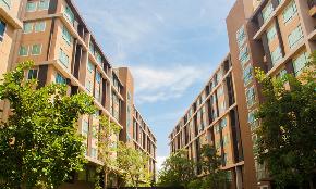
Today, zoning is a key element of real estate due diligence. Surveys such as boundary surveys, ALTA surveys and Topographic surveys are used for almost all real estate deals to define property lines, and map all existing improvements and utilities on the property. In fact, my colleague Christopher Daniels recently wrote an interesting blog on this topic, you can read it here. A zoning report is a necessary component to secure financing, and can advise buyers and lenders whether a site complies with local area requirements and if current or planned uses and developments violate zoning codes.
The Zoning Code is a complex set of laws enacted by local municipalities and counties in unincorporated areas. The laws make up a land use plan and stipulate where and how structures can be built. The normal admiration of these laws is through Zoning Boards, where individuals serve either by election or appointment and under the Code approve applications for development and property modifications. It also will review applications for variances to the Code for individual projects. The Board also may promote the creation of special use zones to attract businesses to its area. Zoning determines what a land owner can or cannot do with his or her land. But how did these rules come to be?
American Zoning in the Early Days
Urban zoning originated in 19th-century Europe as a tool for regulating land and building uses. The first American zoning code was developed in Los Angeles in 1909 as an effort to keep the industrial and commercial activities separated from residential areas. It was promoted in order that residents could maintain their property values. That same year, Boston’s law governing building heights was upheld in the Supreme Court, and by 1913 several states had passed laws allowing cities to control the location of industry.
New York City’s zoning code in 1916 addressed not only the separation of uses but also the physical nature of the buildings that lined the streets. At the time, new building techniques were allowing for taller and taller buildings, which shut out sunlight on the streets below. Upset residents demanded that the city control development to preserve light and air in city streets.
The building that focused the authorities in New York was the 42 story Equitable Building, which, according to the New York Zoning code “Rising without setbacks to its full height of 538 feet, the Equitable Building cast a seven-acre shadow over neighboring buildings, affecting their value” and dropping its 13,000 employees on the already crowded streets at one time. This set the stage for the nation’s first comprehensive zoning effort.
Building Around Codes
The New York zoning code included a trade-off. You could build to the property line up to a certain height but then you would have to set back the façade a certain amount to let more light and air reach street level. The higher you went, the more setbacks were required. Since developers would build to the maximum square footage allowed, this resulted in a proliferation of staggered “pyramids” buildings in the city downtown area, many of which are still part of New York’s world-famous skyline.
In the 1950′s two iconic office buildings were built along Park Avenue, which, along with Fifth Avenue were the high end addresses in the City. The first was Lever House, designed by Skidmore Owings and Merrill. The other one was the Seagram Building, designed by Mies Van Der Rohe, one of the heroes of the Modern Stile architecture. Both these buildings had the same unique feature: a tower set back from the street with either a low two story structure or a completely open plaza facing the street. The result was a wide open space along the avenue.
Based on the wide acceptance of the two buildings, in the 1961 City Zoning Resolution the City created the incentive zoning program which allowed developers increased density in high density areas in turn for the creation of public plazas. From 1961-2000, 320 buildings with 503 public spaces were granted additional floor area or related waivers in exchange for providing these spaces. The results were mixed. In 2007 an amendment was issued that greatly improved the quality of “privately owned public plazas”.
By the 1920′s residential zoning became a tool for preserving the best land for the well-to-do. The fights were in the suburbs where the new profession of “planners” informed the legislative process and was subject to review by the courts, some of them who reflected the feelings of their influential public.
Zoning has proved unpopular in some cities. The traditional separation of residential, commercial and industrial has made the automobile more necessary for buying food and getting to work. The appearance of “Planned Use Development has made it possible to create an area where the quality of life may be enhanced.
Zoning now is in the hands of municipal planning departments, some of whom have led their jurisdictions in creative and rewarding development of the urban and suburban landscape.